
Uig and the Ferry terminal
I wake up about 7:00am. It's blowing plenty. I can't tell if it's raining, or just spray. I get a text message from Mum. There has been a big mudslide on the A84/A85 just after Lochearnhead. 57 people have had to be airlifted to safety. Won't be going home by that route then.
I phone Mum. She's pleased to hear from me. Apparently a village in Cornwall (Boscastle) has been washed away and over 200 people have had to be rescued by helicopter.
Go outside. It's not raining. It's just spray picked up by the wind. I'm slightly surprised to find the bike is still upright. There was a real chance it could have been blown over.
Uig and the Ferry terminal
I have breakfast and check out. Despite the bad weather I'm sorry to leave "White Wave" It's been a cracking little B+B and very friendly. 10:00pm and I'm on the road. Back into Portree and on to Broadford. I do a small detour to Duisdalemore & Camuscross. I noticed them on my way up Skye from the ferry and thought they were very picturesque.
 Camuscross |
 Duisdalemore |
 Duisdalemore |
Back to Broadford and on towards the Kyle of Lochalsh. This is where the highly controversial toll bridge is. It cost me Ł2.90 to cross on the bike. It's hardly the Humber Bridge and I can't see why it is so expensive. According to the locals it is owned by some American conglomerate. The bridge has already paid for itself several times over, but the owners keep finding new excuses to keep the toll prices high.
 The Toll Bridge |
 Kyle of Lochalsh |
Into the Kyle of Lochalsh for a fuel/food stop. I have no idea what a Kyle is or why Lochalsh should have one, but they obviously do.
I carry on down on the A87 for a short distance then take the A890 coastal road. This is labeled the "Wester Ross Coastal Route". A short steep climb into a very foresty section. Then come the spectacular views of Loch Carron. You have to circumnavigate this loch to stay on the coastal road. It requires you to turn of at the head of Loch Carron onto the A896. I stop briefly in the village of Lochcarron, before continuing.
 Me at Lochcarron |
 The head of Loch Kishorn |
Just at the head of Loch Kishorn there is a turn onto an unspecified 'B' road. This is labeled as the coastal route, but also has signs warning learner drivers, HGVs, caravans, or people of a nervous disposition not to use the route. Being a "rufty tufty" biker this route immediately appeals to me and I'm off. It will take me a long way round to the village of Sheildaig, which is only 7 miles by staying on the A896.
 Yes! We'll have some of that |
 View back towards Ardarroch & Achintraid |
 That's where I'm going |
Good climb up and some nice hairpins, but nothing as bad as say the Hard Knott or Wrynose passes in the lakes. On the top I'm in low cloud and there is one hell of a cross wind. There are some observation points but there is no point stopping. Visibility is 20 yards if that. The road looks awfully narrow as I struggle to keep the bike on it. Shades of yesterday. As I come down from the tops and approach Applecross I realise that my arms are aching from fighting the wind. I am really tense. I force myself to relax. I go further down and the wind eases considerably.

The village of Applecross
Eventually you come down into the village of Applecross. As you rise up out the other side, you get good views of the Isle of Raasay to the west. The wind is now tolerable and I crack on round the coastal road, which is now actually not too bad, considering it is a single track 'B' road.
This area is heavily populated by God's dumbest creature. "What! The area of Wester Ross is entirely populated by Volvo drivers?" Oh! Alright then! It is heavily populated by God's second dumbest creature. "Ah! That'll be sheep then!" Yes! Sheep! And they are a liability. See my guide to single track roads for more information on sheep.

The village of Kenmore

The view over Ardheslaig
Through the villages of Kenmore, Ardhaslaig and finally you come across Loch Sheildaig and a short run down to the village of Sheildaig. You rejoin the A896 here and carry on up the south shore of Loch Torridon to Torridon village.
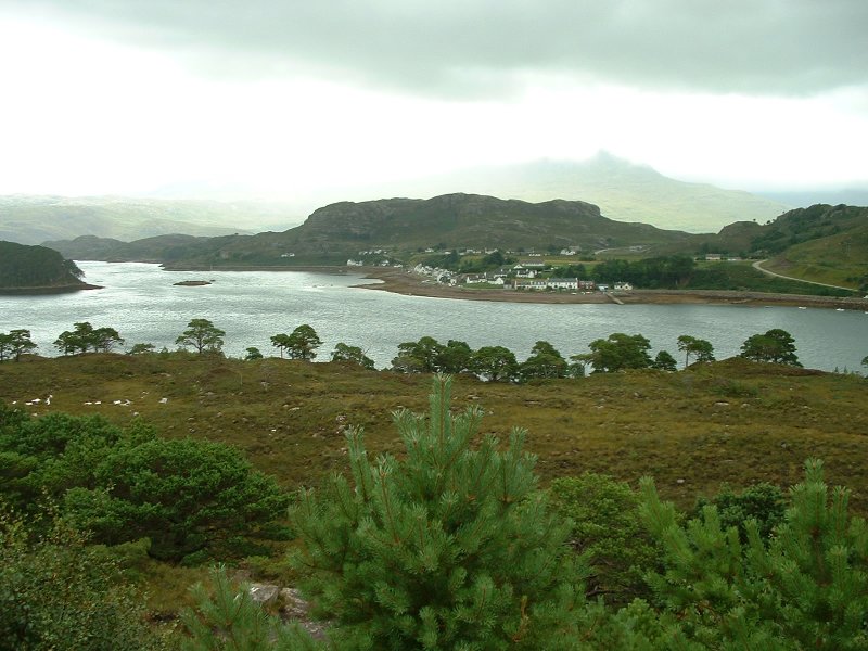 The village of Sheildaig |
 Loch Torridon |
 The village of Torridon |
I had planned to do another walk here, but I abandoned the idea for 4 reasons.
So I abandon the walk and carry on. Up Glen Torridon and up to Kinlochewe. It really begins to rain, but I am prepared this time. Past Loch Maree. It is very foggy or just low cloud, so there is not much to see. I would imagine the views would be quite spectacular otherwise.
Up to Gairloch and Poolewe. The rain is steady all the way and eventually I arrive at Aultbea, a village on the edge of Loch Ewe. It's about 5:00pm. It's been a good ride, but I'm glad to get off the bike. 7 hours is enough for one day.
The B+B is empty. I'm the only one in. Talking to the owners Allan and Anne it was mayhem the night before, just like it was up at "White Wave". They had to turn people away. But this evening there is no one. They have all rung and cancelled. Presumably they have made a dash for home. They are quite surprised to see me. They imagined that being on a bike I would have abandoned the trip yesterday. Not us "rufty tufty" bikers!
 Badfearn B+B |
 View from the window |
"Badfearn" (the B+B) is the house at Cnoc Donn, a working croft. This means that there are lots of sheep and cattle about. Write my notes and read a while. I enquire about somewhere to eat. Aultbea has a whiskey pub, the Drumchork Lodge Hotel. This comes highly recommended by the owners of the B+B. They stop serving food at 9:00pm, so I need to get there about 8:00pm. I was going to walk, but Allan won't here of it. About 8:00pm he gives me a lift in his car to the hotel and instructs me to ring him when I'm ready to come back. This is real service!
 The Drumchork Lodge Hotel |
 The Drumchork Lodge Hotel |
Order the Garlic Mushrooms and the Steak and Ale pie. I have crofter's beer with the meal. Then on to the whiskey. The guy behind the bar (John) really knows his stuff. He takes a few minutes to talk to you and find out what you like/dislike in a whiskey and then pulls some bottle of the shelf and pours you a measure to try. First neat and then with the tiniest drop of water, just to take the harsh edge off without destroying the flavours. Don't drown the whiskey! He considers this point to be very important. I get a measure of "Highland Park". It is a whiskey I've heard of, but not one I've tried. Hmmm! Very nice. I sit the rest of the evening and enjoy it. I order another one and by about 10:00 I get John to phone Allen, who comes out to collect me.